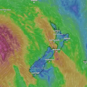
Te Ika-a-Māui/North Island would be “a mainly fine story” today, Neal said, with morning fog and frost in sheltered places.
Early this morning fog restrictions were put in place for Auckland Airport, with two flights cancelled. The restrictions have now been lifted.
Neal said a few morning showers were forecast for Auckland, becoming more isolated toward the evening.
The weather is expected to become more unsettled tomorrow as an “active trough moves east across the country”.
Low-confidence heavy rain is possible about Taranaki Maunga, the central North Island high country, the Tararua Range, Buller and Grey, although no heavy rain watches or warnings have been issued.
“Very cold southwesterlies” are then forecast to sweep across the country on Saturday, bringing shivery chills as the trough moves away to the east.
Snowfall is also possible over South Island hills and ranges on Saturday morning, Neal said.
She added there was a low confidence that warning-level rain could continue about the central North Island high country and Taranaki Maunga.
Southwesterlies in Northland and Auckland also “potentially could reach severe gale”, she said, although the risk remained low.
Conditions are expected to begin easing from Sunday as a low and associated front moves across the North Island while high pressure builds over the South Island.
MetService’s severe weather outlook shows a minimal risk of severe weather by the end of the weekend.