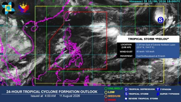
Tropical Storm Peilou moves farther from PH, unlikely to affect local weather
LAPU-LAPU CITY, Cebu — Tropical Storm Peilou is moving farther away from the Philippines and is unlikely to affect the country’s weather conditions, the state weather bureau said Tuesday, August 11.
In its daily forecast, the Philippine Atmospheric, Geophysical and Astronomical Services Administration (Pagasa) said Peilou had a low chance of entering the Philippine Area of Responsibility (PAR).
As of 5 a.m. Tuesday, the storm was located 3,355 kilometers east of Extreme Northern Luzon.
It was packing maximum sustained winds of 85 kilometers per hour near the center and gustiness of up to 105 km/h.
Pagasa said Peilou was last observed moving east-northeastward at 25 km/h.
READ: EXPLAINER: What do color-coded rainfall warnings mean?
Habagat to ease
Pagasa said the southwest monsoon, or habagat, might ease in the coming days, gradually reducing its effects on most parts of the country.
On Tuesday, the habagat will continue to affect parts of Luzon and the Visayas, particularly the western sections.
READ: Deaths from ‘habagat’ rains, storms reach 16
The bureau said significant rainfall, which might trigger flooding and landslides, was possible in Benguet, Pangasinan, Zambales, Bataan, and Occidental Mindoro.
The Visayas and Mindanao, meanwhile, will experience generally fair weather, with chances of localized thunderstorms in the afternoon or evening.
Light to moderate winds and slight to moderate seas will prevail over these areas throughout the day, Pagasa added.
As of Tuesday morning, no gale warning was in effect over the country’s seaboards.
Disclaimer: The comments uploaded on this site do not necessarily represent or reflect the views of management and owner of Cebudailynews. We reserve the right to exclude comments that we deem to be inconsistent with our editorial standards.