A night that would not cool. On the night of July 18, in the depths of the Southern Hemisphere winter, the Argentine city of Salta simply refused to get cold.
The temperature stopped falling at 26 degrees Celsius (78.8 Fahrenheit) and stayed there until sunrise.
To understand how strange that is, picture a July night in Salta as it is meant to be. The city sits at about 1,150 metres in the Lerma Valley, and its winter nights usually drop to 3 to 5 degrees Celsius.
Frost is normal. On this night, the thermometer behaved as though it were a midsummer evening in Chennai.
WHY DID SALTA RECORD ITS WARMEST NIGHT IN WINTER?
The culprit was a wind, not a heatwave in the usual sense.
For several days, Salta lay under an orange alert from Argentina's national weather service, the Servicio Meteorologico Nacional, for a wind called the Zonda.
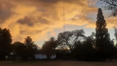
In the middle of the southern winter, the Argentine city of Salta recorded a night that never dropped below 26 degrees Celsius, roughly 20 degrees above normal. A downhill Andean wind called the Zonda, plus a warmer global baseline, explains how a winter night turned tropical. (Photo: X)
On July 18, Salta was the hottest city in the entire country, touching 33.2 degrees Celsius by early afternoon, with gusts strong enough to bring down trees.
WHAT IS THE ZONDA WIND, AND HOW DOES IT HEAT THE AIR?
The Zonda is Argentina's version of the foehn, a wind that gets hot by falling downhill.
Here is the trick. Moist air from the Pacific is pushed up the western face of the Andes. As it climbs, it cools and dumps its moisture as rain or snow on the Chilean side.
The air that spills over the crest and rushes down the eastern slopes is now bone dry, and as it descends, it is squeezed by the growing weight of the atmosphere above it.
Squeezing a gas heats it, exactly as a bicycle pump warms in your hand. Scientists call this adiabatic warming, meaning heat produced by pressure alone, with no fire and no sunlight involved.
Dry descending air warms at roughly 9.8 degrees Celsius for every kilometre it falls, which is why the Zonda can raise temperatures violently and crash humidity into single figures.
Argentine researchers have documented this in detail in a review of Zonda wind science and in modelling studies of foehn events over the Andes.
Crucially, the Zonda also keeps the air churning. On a normal winter night, the ground radiates its heat to space and the still air just above it cools with it.
A gusty, warm, dry wind stirs that layer constantly, so the cooling never gets started.
WHY ARE WARM NIGHTS MORE DANGEROUS THAN HOT DAYS?
Because night is when bodies repair themselves. Sleep is how humans shed the heat load of the day, and above roughly 26 degrees, sleep quality collapses for people without cooling.
Warm nights also strip the buffer from everything else. Buildings stay hot, hospitals fill, electricity demand climbs, and in Salta's case, tinder dry vegetation plus wind meant fire risk.
IS CLIMATE CHANGE BEHIND SALTA'S RECORD WARM NIGHT?
Not directly. The Zonda is an ancient, entirely natural wind and would have blown regardless.
But the IPCC's assessment notes that night-time minimum temperatures have risen faster than daytime maximums almost everywhere.
A warmer baseline means every Zonda now starts from a higher rung. The wind supplies the drama. The climate supplies a head start.
- Ends
Published By:
Radifah Kabir
Published On:
Jul 21, 2026 20:17 IST