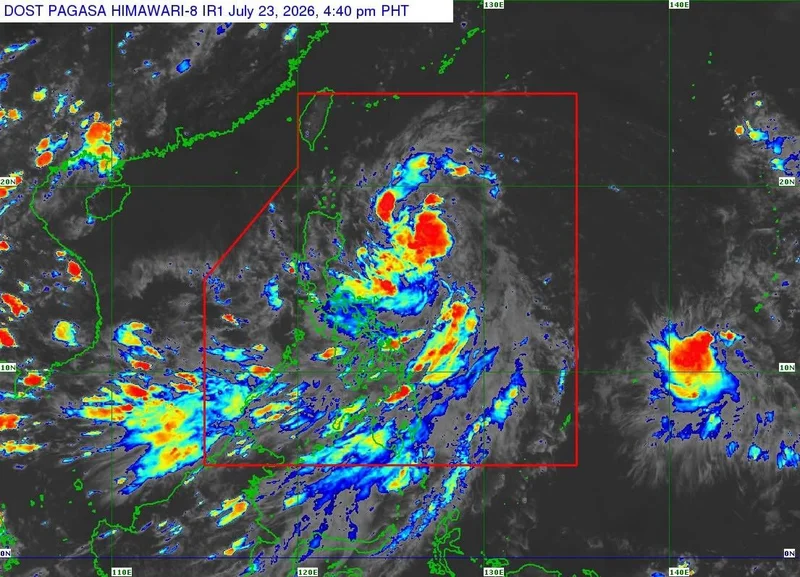
MANILA, Philippines — Fourteen areas in Northern Luzon are now under Signal No. 1 as Tropical Depression Kiyapo continues to move northwestward over the Philippine Sea, PAGASA said Thursday.
In a press briefing on Thursday, July 23, PAGASA weather specialist John Manalo said the tropical depression was estimated to be 640 kilometers east of Tuguegarao City, Cagayan, as of 4 p.m.
Kiyapo is moving northwestward at 30 kilometers per hour (kph), with maximum sustained winds of 45 kph and gusts of up to 55 kph.
PAGASA has hoisted Tropical Cyclone Wind Signal No. 1 over the following areas in Northern Luzon:
- Batanes
- Cagayan (including the Babuyan Islands)
- Ilocos Norte
- Apayao
- Ilocos Sur
- Abra
- Kalinga
- Isabela
- Mountain Province
- Ifugao
- The northern portion of Nueva Vizcaya
- The northern portion of Benguet
- The northern portion of Quirino
- The northern portion of Aurora
The state weather bureau expects Kiyapo to maintain its tropical depression strength as it nears the Babuyan Islands.
However, it is forecast to intensify into a tropical storm by Thursday afternoon.
Because of its slightly accelerated pace, the cyclone is projected to exit the Philippine Area of Responsibility (PAR) early Saturday morning.
Once outside the PAR, over the sea between the Philippines and the southeastern coast of China, the storm is forecast to further intensify into a severe tropical storm before making landfall in southeastern China.