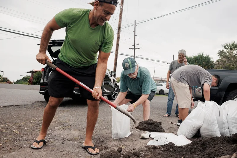
Hurricane Lala gathered strength on Saturday as it moved along a track that could result in a rare direct landfall on Hawaii’s Big Island.
The National Hurricane Center upgraded Lala to a Category 1 hurricane after maximum sustained winds reached 75 mph (120 kph). The storm’s eyewall was projected to pass over or near the southern end of the island by Saturday evening, bringing its strongest winds to high-altitude volcanic slopes.
The Big Island has not experienced a direct hurricane landfall in 155 years. Regardless of whether the eye makes landfall, meteorologists warned that higher elevations near the Mauna Kea volcano could receive up to 25 inches (63.5 centimeters) of rain.
The rainfall creates a risk of life-threatening mudslides in mountainous areas where residents live off the grid in improvised housing. Officials urged individuals in vulnerable locations to seek safe shelter immediately.
Even if the system drops slightly below hurricane strength, the NHC noted that wind speeds across mountain peaks and both windward and leeward slopes "are often up to 30% stronger than the near-surface winds" cited in its advisories.
"This is an enormous storm," Gov. Josh Green said. Tropical storm-force winds stretched outward up to 220 miles (350 km), with effects expected to reach Oahu and Kauai by Sunday morning.
Heavy flooding and wind-driven wildfires are potential hazards across the island chain.
Mike Caputo, a 50-year-old local fire captain living in Keaau on the east side of the Big Island, said the principal threats are flash flooding and falling trees, particularly the albizia species.
"They’re not very sturdy but they grow extremely large," Caputo said. "They can make roads impassable. I made sure my trees were trimmed a few days ago."
Tropical storm warnings have been declared for Maui, Molokai, Lanai, Kahoolawe, Oahu, Kauai, and Niihau.
Historical research into newspaper records by a University of Hawaii atmospheric scientist indicates that a Category 3 hurricane struck the northeastern shore of the Big Island in 1871. Current models show Lala tracking "very close to the southern tip of the Big Island," according to Vanessa Almanza, a National Weather Service meteorologist in Honolulu.
Authorities and residents took precautions across the region. Public shelters were opened, community events were canceled, and ranchers were advised to leave cattle in open pastures rather than structures susceptible to collapse. "It doesn’t take landfall to create destruction," Almanza said.
Forecasters expect total rainfall of 8 to 12 inches (20.3 to 30.5 centimeters) across Maui and lower areas of the Big Island, with 4 to 6 inches (10.2 to 15.2 centimeters) predicted across the remainder of the island chain.
The hurricane center also warned that the storm could cause "life-threatening flooding and mudslides, especially in areas of steep terrain," alongside hazardous storm surges and ocean swells "likely to cause life-threatening surf and rip current conditions."
As of 8 a.m. local time, Tropical Storm Lala was positioned approximately 90 miles (145 kilometers) southeast of South Point and about 300 miles (485 kilometers) southeast of Honolulu, carrying maximum sustained winds of 70 mph (110 kph) while moving west-northwest at 12 mph (19 kph).
Authorities urge vigilance
State Representative Jeanné Kapela urged residents to remain cautious. The southern portion of the island is rural and remote, featuring coffee farms and cattle ranches, but has seen recent population growth due to lower living costs. Kapela expressed concern for residents living off the grid in unpermitted homes.
"If you feel now that your house doesn’t have a great roof or might not be able to withstand hurricane force winds, then first things first you go to a family or friend’s house and you kind of hunker down there," she told The Associated Press. "We're hopeful the storm moves through quickly, but we're preparing for whatever comes."
The impending storm follows severe flooding that affected many residents in March. Agricultural producers are concerned about experiencing further crop damage, according to Hawaii Farm Bureau director Brian Miyamoto.
Wind increases fire concerns
As wind speeds increase across the archipelago, dry and breezy conditions outside the primary storm zone will elevate wildfire risks, Almanza noted.
In 2023, the town of Lahaina on Maui was destroyed by a severe fire driven by powerful winds from a hurricane passing far to the south.
"Since the fire, everybody is way more aware of weather in general and our environment and things that are happening," said Archie Kalepa, a Lahaina resident known for his ocean skills who has been closely monitoring the storm.
To the northwest, Kauai was hit by Hurricane Iniki as a Category 4 storm in 1992—an El Nino year similar to current climate patterns, where warming waters in the equatorial Pacific enhance hurricane activity.
"It did $3 billion worth of damage. It destroyed thousands of homes, and it did kill six people," said Steven Businger, the professor who conducted the historical research on the 1871 storm. "We just can never know if a storm is going to turn."