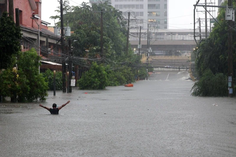
Metro Manila flooding: It’s not just the rain—here’s what can help
MANILA, Philippines — Heavy rainfall volume, limited capacity of waterways and Metro Manila’s flood-prone geography were cited as factors behind the severe flooding that swamped the region on Monday, August 17.
These factors, according to Project NOAH (Nationwide Operational Assessment of Hazards) Executive Director Mahar Lagmay, can be managed before the government spends money on more flood control infrastructure.
Among the potential interventions he cited are nature-based solutions like retention basins, rainwater harvesting and “sponge roads” or urban streets designed with porous materials to absorb rainwater.
Lagmay told ANC on Wednesday, August 18, that Metro Manila experienced severe flooding because the existing flood control infrastructure can only accommodate a limited volume of floodwaters.
The structures, he explained, were overwhelmed by the 201.7 millimeters of rainfall within five hours across the region.
“Malakas talaga 'yung ulan kahapon, expected po na talagang magbabaha. ‘Yung mga flood control structures natin ay designed to accommodate only so much. Pero na-overwhelm talaga kasi the design is not fit for that,” Lagmay said.
(Yesterday’s rainfall was really heavy, flooding was expected. Our flood control structures were designed to accommodate only so much. But these were overwhelmed because the design is not fit for that.)
Lagmay’s account aligns with the Metropolitan Manila Development Authority’s explanation of why the metropolis was flooded.
“So nakita natin, kahapon, ay sa isang napakaiksing panahon, binagsak ng langit ang almost kalahati ng Ondoy in 24 hours, so maiintindihan natin na talagang aapaw,” MMDA General Manager Nicolas Torre III said in a separate interview with ANC, referring to Metro Manila’s limited waterways.
(So we saw yesterday that the downpour within a few hours was almost half of what Ondoy made in 24 hours. So it is understandable that [the waterways] will overflow.)
Metro Manila sits in ‘delta’
Also contributing to Metro Manila’s vulnerability is its flood-prone geography.
Lagmay said that Metro Manila and its neighboring province, Bulacan, are situated in naturally low-lying areas called "deltas" that were formed because of floods.
“That delta was formed because of floods. Kapag mayroong mga river, waters na lumalabas, dina-dump niya ‘yung soil, ‘yung silt and then form the delta,” Lagmay explained.
(That delta was formed because of floods. If there are rivers, waters released, soil and silt were dumped and then form the delta.)
Lagmay said these flood-prone areas, which are typically near bodies of water like rivers and streams, have been identified since 2012.
“We are in an urbanized area sitting on land that is really flood-prone,” Lagmay said.
Several major routes became totally impassable for motorists and commuters from morning until late evening as floodwaters reached at least 26 inches or tire-level deep on Monday. In Quezon City, some areas were reported to experience above-head-level flooding.
Mitigation measures
Lagmay emphasized that nature-based interventions are available to manage flooding and prevent it from reaching and accumulating in low-lying areas like Metro Manila.
For a short-term solution, Lagmay suggested using accurate weather forecasts and identifying flood-prone areas to move residents out of harm’s way during heavy rains or storms.
Meanwhile, proposed medium- to long-term solutions include studying land and creating simulations to test the effectiveness of flood mitigation projects before putting in dikes and flood infrastructure.
He also cited nature-based solutions like retention basins, rainwater harvesting and “sponge roads” to lessen the amount of floodwater accumulating in naturally flood-prone areas.
“The idea being, before the water peaks dun sa low-lying areas na magkasabay-sabay sila, nabawasan na kasi kinapture mo na ‘yung water in small amounts,” Lagmay said.
- Latest
- Trending