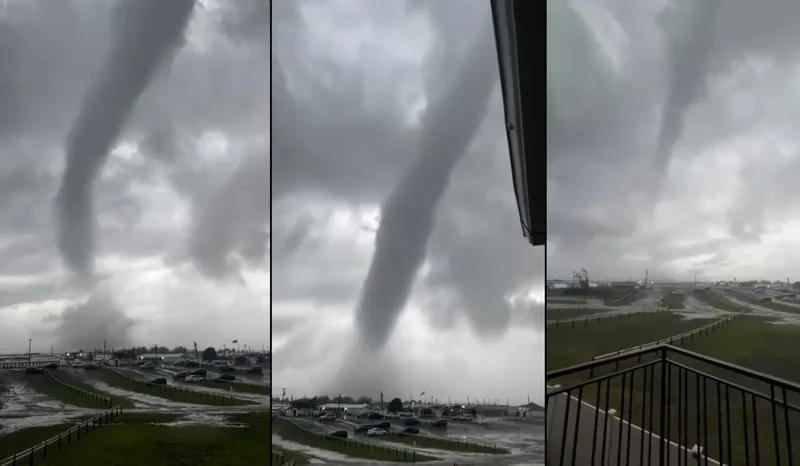
New York City is no stranger to storms. Summers in the Big Apple can bring torrential, sudden rains, with water flooding into intersections and cascading down subway stairs, while Nor’easters are de rigueur in the winter. Tornadoes, however, are fairly rare. So why did a twister touch down on Thursday in Nassau County on Long Island and a possible second hit the Rockaways in Queens? The answer lies in the atmosphere.
Tornadoes are common in the central and Southeastern U.S., but they can happen anywhere where conditions are ripe: namely, an unstable, moist atmosphere and rotation in a storm. Those are precisely the conditions that drenched an area from northeast New Jersey to far out on Long Island on Thursday evening, with rainfall of 4 to 5 inches in the worst-hit places, says Dave Radell, a meteorologist at the National Weather Service. Flash flooding was widely reported in the area, too.
But what got the most attention on the news and social media were those rotating clouds, which took locals by surprise. The Atlantic Beach twister began as a tornadic waterspout—essentially, a tornado that forms over water. (Fair weather waterspouts, which are common over South Florida in the late spring to early fall, also exist, forming along the bases of developing cumulus clouds, versus the severe thunderstorms that spawn tornadoes.)
On supporting science journalism
If you're enjoying this article, consider supporting our award-winning journalism by subscribing. By purchasing a subscription you are helping to ensure the future of impactful stories about the discoveries and ideas shaping our world today.
That waterspout then came ashore, causing damage to nearby buildings and cabanas. There was also a radar signature showing cloud rotation near Far Rockaway in Queens, but there is no photographic evidence or reported damage, Radell says. Teams from the NWS are going out to investigate the damage to determine how long the first tornado lasted, how wide it was and how strong its winds were. They will also be looking for evidence of whether the second possible tornado touched the ground.
Tornadoes happen less often in New York and New Jersey because the atmosphere above this region rarely sees the powerful collisions between cold, dry air from the north and warm, moist air from the south that happens over the Plains and the Southeast, particularly in the spring. Between 1950 and 2022, there were 88 tornadoes reported across all of New York State, most of which would equate to an EF0 or 1, the lowest on the tornado ranking scale.
One of the last times tornadoes were reported in the New York City area was on November 13, 2021, when several hit Long Island. And a situation similar to yesterday’s happened in 2012, when what began as a waterspout came ashore in Brooklyn, Radell says.
“This isn’t unprecedented, but it certainly isn’t something that happens every year,” Radell says.