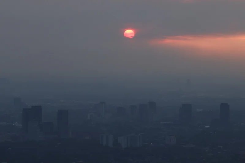
As a brown pall of smoke from Ontario forest fires descended on the northeastern United States earlier this month, President Donald Trump seized the opportunity to blame Canada for mismanaging its forests. He also threatened to impose new tariffs because of it.
A new study that unpacks where wildfire smoke actually comes from makes plain why the logic behind the U.S. President’s assertion is flawed.
It turns out Mr. Trump and those who echo him should not be looking northward when complaining about the smoke-filled air, but downward.
As the study makes clear, some three-quarters of emissions from wildfires like those now raging across northwestern Ontario and elsewhere in Canada come not from burning trees and surface vegetation, but from carbon locked in the soil.
That startling result, backed by field data from Canada’s record fire season of 2023, carries big implications for what everyone should expect from boreal wildfires going forward.
It underscores the reality that there is going to be plenty of smoke heading toward North American cities over the coming years. And its production has very little to do with forestry management practices.
“Public perception of fire is very different from reality,” said Alemu Gonsamo, a remote sensing specialist at McMaster University in Hamilton who co-led the study.
Published Monday in the journal Geophysical Research Letters, the study is the culmination of a three-year effort to put hard numbers behind the growing phenomenon of continent-scale smoke events.
The events of 2023 were a key motivator for the work. That summer, wildfire burned a total of 150,000 square kilometres across Canada, about 4 per cent of the country’s forests, corresponding to an area more than double the size of New Brunswick.
In June that year, smoke poured from extensive fires in northern Quebec and enveloped U.S. cities, including New York and Washington, in a noxious haze.
Elsewhere, smoke production was augmented by similarly severe fires in Alberta, British Columbia and the Northwest Territories. Besides the impact on air quality, the results mattered on a global scale because of the quantity of carbon released by the fires.
“The 2023 Canadian fires emitted as much carbon as the fossil-fuel emissions of a large country,” said Sander Veraverbeke, an earth systems scientist at the Vrije Universiteit Amsterdam and co-author of the new study.
Several research teams attempted to estimate the total combined emissions that Canadian fires produced in 2023.
This can be done in a variety of ways. Europe’s Copernicus Atmosphere Monitoring Service combines space-based observations with computer models to measure the amount of tiny carbon-bearing particles suspended in the atmosphere while fires are under way. Others rely on measurements of the concentration of carbon monoxide, which serves as a trace gas for combustion.
U.S. President Donald Trump has threatened to tariff Canada over the wildfire smoke that has 'invaded' major cities like New York and Chicago, saying we aren't doing enough to manage the fires. The Globe’s Jesse Winter, who has covered wildfires for years, explains what Trump’s claims overlook.
Alex Migdal/The Globe and Mail
In 2024, a study led by researchers at NASA’s Jet Propulsion Laboratory compared such top-down methods based on fire byproducts with bottom-up methods that consider the total area burned. The result put the total emissions from Canadian wildfires somewhere in the range of 469 million to 639 million tonnes of carbon. That corresponds to about two-thirds of the total annual amount of carbon released in India, the world’s third-largest producer of fossil-fuel emissions.
In the new study, Dr. Gonsamo and his colleagues sought to confirm that number but also do something more: Calculate the separate contributions to total emissions from the burning of above-ground vegetation and from carbon in the soil.
If one pictures logs burning on a campfire, it’s hard to imagine that the earth below the fire would have much to contribute to the smoke that the fire produces.
Forests, however, do not burn like campfires on bare ground. For all the carbon that resides in branches, stems and leaves of the visible forest, a much larger and denser storehouse of carbon resides in the layers of decaying vegetation that make up the forest floor, built up over many years. If the soil is sufficiently dry, it will burn readily during a forest fire and typically release a large amount of carbon relative to the surface vegetation, including in the form of smoke.
Under the surface
A detailed map of soil carbon in Northwestern Ontario reveals that areas burned in this month's wildfires typically contain 20 to 60 kg of carbon per square metre in the top 1 metre of soil. New research shows that this can be expected to account for about three quarters of total carbon emissions, including smoke, from the fires. Areas to the north with more than 90 kg carbon per square metre of soil can produce even greater emissions when dry enough to burn.
Detail
Ottawa
Carbon stored in soil
Toronto
Kilograms per square metre
0
100
Areas burned due
to wildfires in 2026
As of July 24
Fort Severn
Big Beaver House
Lansdowne House
Cat Lake
Sioux Lookout
Dryden
Atikokan
Thunder Bay
MURAT YÜKSELIR / THE GLOBE AND MAIL, SOURCE: MCMASTER UNIVERSITY, SCHOOL OF EARTH, ENVIRONMENT AND SOCIETY, WORLD WILDLIFE FUND CANADA; CANADIAN WILDLAND FIRE INFORMATION SYSTEM
Under the surface
A detailed map of soil carbon in Northwestern Ontario reveals that areas burned in this month's wildfires typically contain 20 to 60 kg of carbon per square metre in the top 1 metre of soil. New research shows that this can be expected to account for about three quarters of total carbon emissions, including smoke, from the fires. Areas to the north with more than 90 kg carbon per square metre of soil can produce even greater emissions when dry enough to burn.
Detail
Ottawa
Carbon stored in soil
Kilograms per square metre
Toronto
0
100
Areas burned due
to wildfires in 2026
As of July 24
Fort Severn
Big Beaver House
Deer
Lake
Lansdowne House
Cat Lake
Red Lake
Sioux Lookout
Dryden
Atikokan
Thunder Bay
MURAT YÜKSELIR / THE GLOBE AND MAIL, SOURCE: MCMASTER UNIVERSITY, SCHOOL OF EARTH, ENVIRONMENT AND SOCIETY, WORLD WILDLIFE FUND CANADA; CANADIAN WILDLAND FIRE INFORMATION SYSTEM
Under the surface
A detailed map of soil carbon in Northwestern Ontario reveals that areas burned in this month's wildfires typically contain 20 to 60 kg of carbon per square metre in the top 1 metre of soil. New research shows that this can be expected to account for about three quarters of total carbon emissions, including smoke, from the fires. Areas to the north with more than 90 kg carbon per square metre of soil can produce even greater emissions when dry enough to burn.
Detail
Carbon stored in soil
Ottawa
Kilograms per square metre
Fort Severn
0
100
Toronto
Areas burned due
to wildfires in 2026
As of July 24
Big Beaver House
Deer Lake
Attawapiskat
Lansdowne House
Cat Lake
Red Lake
Moosonee
Sioux Lookout
Kenora
Dryden
Hearst
Atikokan
Timmins
Thunder Bay
MURAT YÜKSELIR / THE GLOBE AND MAIL, SOURCE: MCMASTER UNIVERSITY, SCHOOL OF EARTH, ENVIRONMENT AND SOCIETY, WORLD WILDLIFE FUND CANADA; CANADIAN WILDLAND FIRE INFORMATION SYSTEM
This has always been true, but extreme weather events driven by climate change have resulted in hotter and drier periods that promote the burning of soil carbon.
“Even if you have massive resources to manage fire or to apply preventative measures, there’s no way we can avoid this,” Dr. Gonsamo said.
To determine precisely how much carbon is released during a large fire, Dr. Gonsamo and his colleagues relied on a Canada-wide soil carbon inventory that McMaster researchers produced in 2021 based on remote sensing data. They also conducted detailed fieldwork in areas that were burned in 2023, particularly in northern Quebec. This allowed them to connect the degree of burning below ground with the carbon content of the soil.
The team based its analysis on sections of landscape as small as 30 by 30 metres across to account for the variability in carbon content across large areas. They also employed machine learning techniques to apply the results more broadly.
Based on this approach, the team found that the above-ground contribution from the 2023 Canadian wildfires equalled 131 million tonnes of carbon while the below-ground figure was slightly more than three times higher, accounting for about 76 per cent of total emissions. Altogether, the group found, the emissions totalled 554 million tonnes.
While the study does not include the 2026 fires, the inventory shows that the burning areas that caused so much smoke in American cities earlier this month have a similar level of carbon content as the Quebec burn area. That suggests that a similar portion of the smoke, about three-quarters, originated as carbon below ground.
Werner Kurz, a retired research scientist with Natural Resources Canada who advised the project, noted that climate change is having multiple interlinked effects on wildfires. In addition to hot, dry weather increasing the severity of fire, conditions are lowering the water table and accelerating the retreat of permafrost, both of which make a larger cache of soil carbon available for burning.
“One thing we can say with confidence is we should be anticipating more carbon released from these landscapes,” Dr. Kurz said.
Mike Flannigan, a fire scientist at the University of Alberta who was not part of the study, pointed to the phenomenon of flash drought, a sudden onset of drying that is driven by extremely high temperatures. He said it is likely to exacerbate the situation in areas where dampness may have previously moderated how much carbon is drawn from the ground during a fire, while also making it easier for such fires to grow rapidly before a response is possible.
“There’s no way we can stop some of these larger fires from burning,” he said. “And if it’s a north wind, well, our neighbors to the south will get the smoke.”