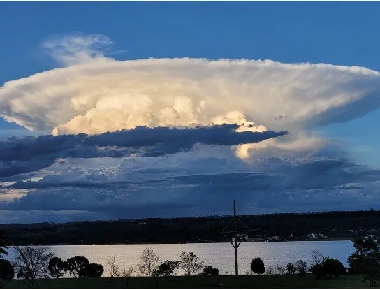
Brazil Bomb Cyclone: Red Alert for Rio Grande do Sul
Weather · Brazil & Uruguay
This is no longer a forecast. The storm line is reaching Rio Grande do Sul now, and the official advice for anyone in its path is the simplest kind: get inside and stay there.
What the red alert actually says
INMET, Brazil’s national meteorological institute, has 214 municipalities in Rio Grande do Sul under an alert graded Grande Perigo — great danger, the highest of its four levels. It runs until 23:59 on Thursday.
The notice warns of gusts above 100 km/h, rain exceeding 60 mm in an hour or 100 mm in a day, and hail. It lists a high risk of damage to buildings, power cuts, crop losses, trees down, flooding and road disruption.
Its instruction is unusually blunt for a weather bulletin: seek shelter, and avoid remaining outdoors. Six mesoregions are inside the red zone, including Metropolitana de Porto Alegre.
What a bomb cyclone is, in one paragraph
The name describes a measurable thing rather than a level of drama: an extratropical low whose central pressure falls unusually fast, which is what makes the winds around it accelerate so sharply.
This one is deepening hard. INMET has its central pressure falling roughly 26 hectopascals in 24 hours, bottoming near 940 hPa on Saturday. That rate of collapse is what earns the label.
The low is forming between Uruguay and the Rio Grande do Sul coast and tracking southeast over the Atlantic, which keeps the fiercest winds offshore and along the coastal strip rather than deep inland.
Where else is under warning
A separate orange alert covers 914 municipalities across Rio Grande do Sul, Santa Catarina, Paraná and Mato Grosso do Sul until Friday morning, with gusts of 60 to 100 km/h.
São Paulo, Rio de Janeiro and Minas Gerais are covered by lower-grade notices. That makes seven states under storm alerts, and a wider set again if the separate high-wind advisory is counted.
Rio Grande do Sul is the state to watch, and not only because of the wind. More than a thousand people are still displaced from the storms that hit the state in late July, and the ground has not dried out.
São Paulo opens a crisis cabinet
The state civil defence set up a crisis cabinet on Thursday. Winds start modest and build through Friday into Saturday.
Gusts of up to 100 km/h are expected along the São Paulo coast, across Greater São Paulo, and in the Vale do Ribeira and Vale do Paraíba. The warning names falling trees, roofs torn off, and poles, signs and billboards coming down.
That list is not hypothetical. Windstorms killed people in São Paulo and Rio de Janeiro just over a week ago. Check the São Paulo daily brief and the Rio de Janeiro daily brief for daily detail.
Uruguay: serious, but not extreme
INUMET, Uruguay’s meteorological institute, has issued a special notice rather than a formal warning. It expects sustained winds of 40 to 70 km/h and gusts of 70 to 100 km/h, occasionally higher.
The affected area is south of the Río Negro, principally the coastal zone. Figures circulating above 150 km/h do not come from INUMET and should be treated with scepticism.
What to do, if you are in the path
Follow the official instruction first: while the red alert is in force, get indoors and stay there. Do not shelter under a tree — falling limbs are the most common cause of injury in these storms.
Keep away from billboards, hoardings and transmission towers, and do not park beneath them. Unplug appliances, and switch off at the board if lightning is close.
Expect the power to go. Charge phones now, fill a water container, and keep some cash — card terminals fail when the electricity does.
If you must travel, check before you leave rather than after you arrive. Airports and coastal shipping are both exposed at these wind speeds.
The wider pattern
Southern Brazil has become a reliable producer of these systems, and the warning machinery around them has visibly improved. This alert went out with a named danger level, a municipality count, a validity window and a plain instruction.
That is worth noticing. Chile has spent weeks clearing up after its own winter storms, and the difference in preparedness across the continent is now measured in hours of warning rather than in rhetoric.
For the region’s other currents this week, political and economic, see the Latin American Pulse.
Frequently Asked Questions
How strong are the winds in Rio Grande do Sul?
INMET's red alert warns of gusts above 100 km/h in 214 municipalities of Rio Grande do Sul, alongside rain of more than 60 mm an hour and hail. A separate orange alert covering a wider area, including Santa Catarina, Paraná and Mato Grosso do Sul, puts gusts at 60 to 100 km/h.
What does a red alert mean, and what should I do?
Red is INMET's highest level, labelled Grande Perigo, or great danger. Its official instruction is to seek shelter and avoid remaining outdoors while the alert is in force. Greater Porto Alegre is inside the red zone, and the notice runs until 23:59 on Thursday.
Which states are affected, and for how long?
Seven states are under storm alerts: Rio Grande do Sul, Santa Catarina, Paraná and Mato Grosso do Sul on the higher grades, with São Paulo, Rio de Janeiro and Minas Gerais on lower notices. The system runs from Thursday 6 to Saturday 8 August and is strongest on Friday and Saturday along the coast.
Is there a tornado risk?
Forecasters have not ruled out isolated extreme-wind events, including microbursts and tornadoes, in Rio Grande do Sul. That is a localised possibility rather than a general forecast, and INMET's red alert does not list tornadoes among its named risks. The widespread hazards are wind damage, hail, flooding and power cuts.
Sources: INMET — avisos meteorológicos ativos (official active alerts), INUMET — tormentas muy fuertes, puntualmente severas (Uruguay, 5 August 2026), Entenda o que é o ciclone bomba que pode atingir o Sul do país (Agência Brasil)
This article was produced by The Rio Times’ automated newsroom system. How we use AI · Report an error