Obet approaches PAR, to enhance monsoon anew
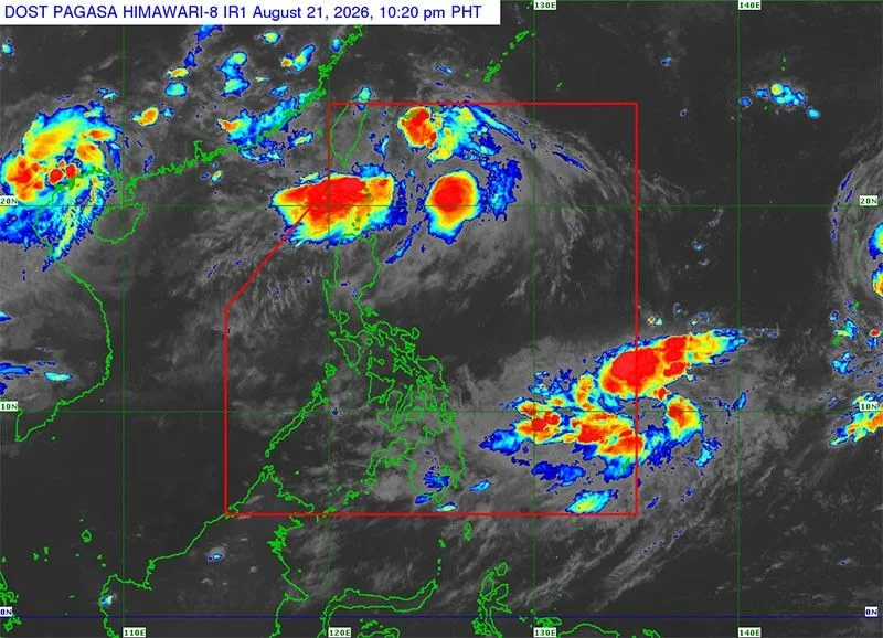
MANILA, Philippines — A tropical cyclone, with international name Saudel, has intensified into a severe tropical storm ahead of its entry into the Philippine area of responsibility (PAR) next week.
Saudel was located yesterday at 2,635 kilometers east of Southeastern Luzon, moving north-northwest at 20 kms per hour.
It was packing winds of 110 kph and gusts of 135 kph and is expected to enter the country as early as Monday and at the latest on Wednesday.
Should it enter PAR, it will be given the local name Obet. It will be the 15th tropical cyclone this year and the fourth this month after Luis, Maymay and Neneng.
While it is not expected to directly affect the country, Philippine Atmospheric, Geophysical and Astronomical Services Administration weather specialist Benison Estareja said it will enhance the southwest monsoon.
Meanwhile, the low-pressure area (LPA), formerly Neneng, was last located at 720 kms north northeast of Itbayat, Batanes.
Another LPA outside PAR is now 1,440 km east of northeastern Mindanao and has a medium chance of developing into a tropical cyclone in the next 24 hours.
Northern and Central Luzon may expect the effects of the enhanced monsoon, bringing light to moderate rains today while cloudy skies with scattered rains and thunderstorms will be felt in Ilocos Region, Apayao, Abra, Benguet, Batanes and Cagayan.
Metro Manila, the rest of Cordillera Administrative Region, the rest of Cagayan Valley, Central Luzon and Calabarzon will have partly cloudy to cloudy skies with isolated rainshowers or thunderstorms also due to the monsoon.
The rest of the country will experience partly cloudy to cloudy skies with isolated rainshowers or thunderstorms due to localized thunderstorms.
- Latest
- Trending